The Connected States Of America
AT&T and IBM Research have collaborated to create an infographic and interactive map to show how mobile phones are shaping…


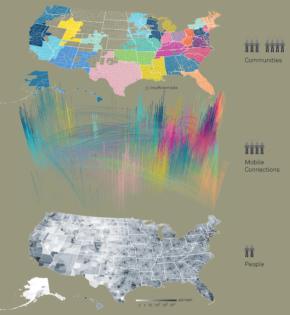
AT&T and IBM Research have collaborated to create an infographic and interactive map to show how mobile phones are shaping social interaction. The two companies gathered mobile phone data from across the USA, and discovered that community boundaries are not necessarily determined by geography or the established by State boundaries. In the infographic, they show that communities are becoming defined by social interaction, especially in cities where people are migrating and commuting more regularly and new technology enables relationships and connections to be maintained regardless of physical distance. The nature of communication using phones has been explored, exposing interesting results regarding communication between counties and within states. They have even illustrated their findings in an interactive map, which you can find here, showing detailed statistics about phone calls and text messages in specific states and counties. It's interesting to see the impact of the phone on societies and relationships, and how community boundaries can become interwoven as technology makes it easier for people to connect from long distances.
Discussion