MIT’s Senseable City Lab
We love a bit of data, and the folks at Massachusetts Institute of Technology‚Äôs Senseable City Lab are consistently…

We love a bit of data, and the folks at Massachusetts Institute of Technology’sSenseable City Lab are consistently wowing us with theirs. What they do is explore the “real-time city,” where we live, what we do, how we do. Working with a general theme of sensed data (mobile phones, tracking devices and flickr pictures) they study the way these sensors and electronics relate to the built environment.
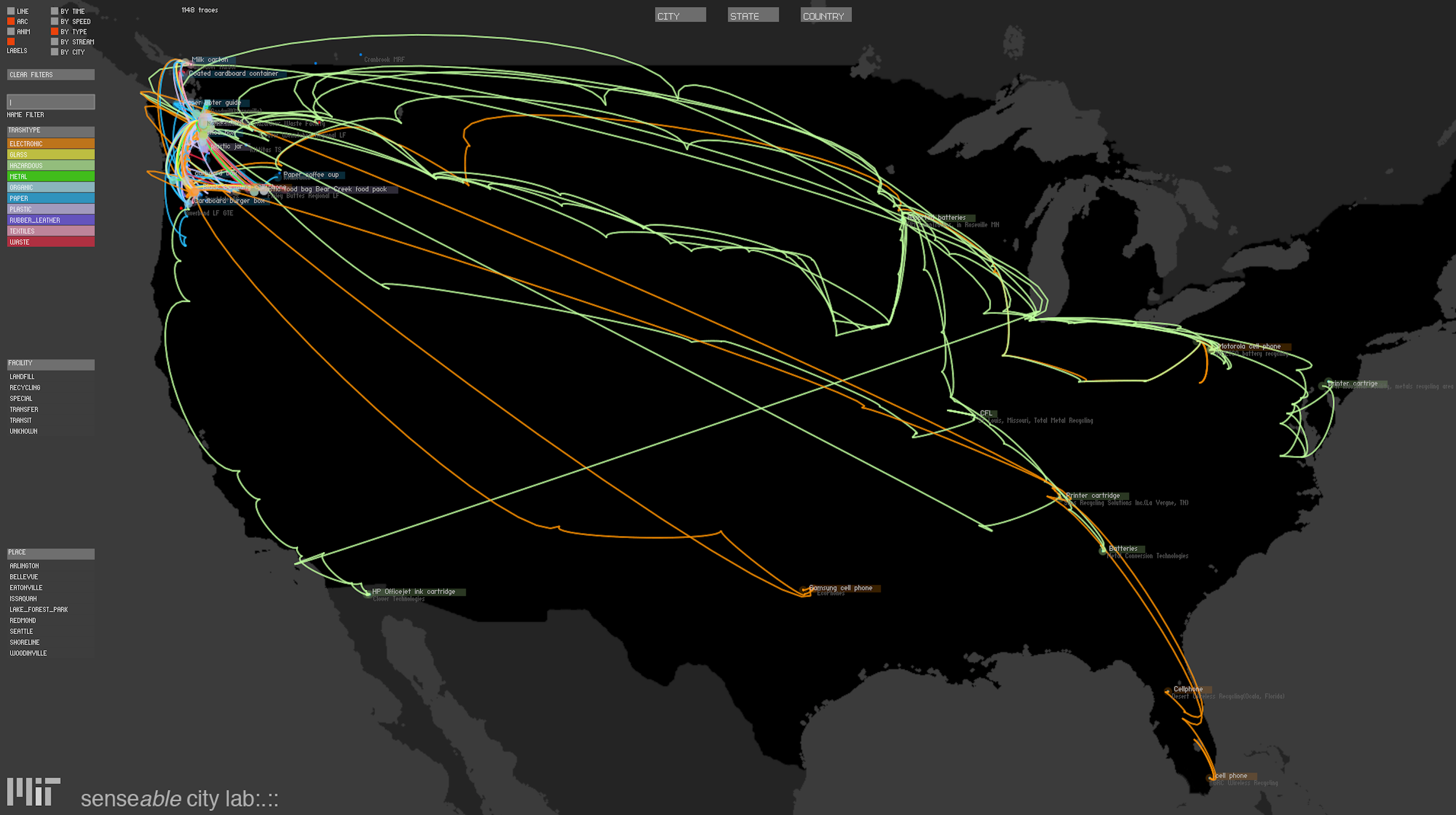
What they reveal is a new layer of information on our urban space, a new way to experience and describe the city and a truly eye-opening insight into society. Take for example 2009’s US presidential inauguration, with Obama victorious MIT’s Sensable City Lab tracked the usage for mobile phones, showing a clear indication of dips and peaks in relation to the ongoing events, watching the speech and making celebratory calls. They’ve also created a real-time carbon-footprint tracker, bikes that are used to capture data, and in Seattle 500 volunteers attached cellular tracking devices to their 3000 pieces of trash, enabling us to see it through the entire waste disposal process. Did we mention they visualize the resulting data too? That’s the best bit. See the data viz for Trash Track above.
With pressing issues of urbanization and a ever increasing wave of new distributed technologies, Senseable City Lab are on top of it and urban data collecting has never been cooler. We think the trend for data collecting is definitely on the up, keep up to date with MIT's Senseable City Lab's latest projects here.
Discussion