Mapping Manhattan
Collecting and mapping the hand-drawn experiences of 75 New York residents, this book aims to draw a unique picture of the city that never sleeps.


Cities are more than fixed, navigable structures: they are organisms constructed of real moments of human history. And over the last year or so, we’ve seen a slew of apps seeking to reintroduce notions of randomness to the erstwhile practical realm of digital mobile mapping, together with several hand-drawn maps seeking to re-humanize modern cartography.
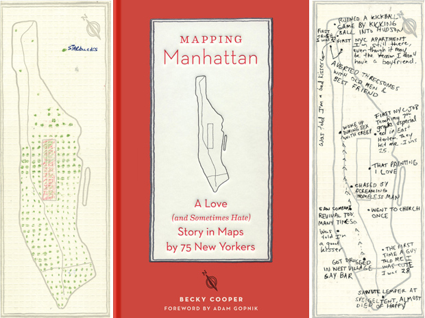
A new book, Mapping Manhattan: A Love (and Sometimes Hate) Story in Maps by 75 New Yorkers, is a new example of the latter that similarly celebrates the serendipity of the former.
With hundreds of hand-printed blank maps of New York’s Manhattan in-hand, author Becky Cooper walked the length of the urban island from tip to tail starting in 2009, asking the various New Yorkers she met en route to fill in her blank urban outlines with their own memories and experiences and post them back to her. A kind of analogue crowd-sourcing, she then combined a collection of these, together with a series of commissions, into a book. The result, Mapping Manhattan, tells the tale of a different New York. One lived, shaped and remembered by real people – from policemen and fashion models to homeless people and senior citizens, and everyone in-between.


Discussion