Mapping iPhones Over Europe
Like fireflies at night, designer Michael Kreil of Crowdflow has used cell phone location data to beautifully visualise people's…

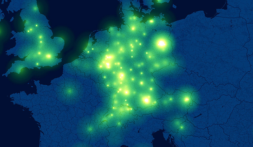
Like fireflies at night, designer Michael Kreil of Crowdflow has used cell phone location data to beautifully visualise people's daily travels.
It is now well known that iPhones are continuously tracking, recording and storing data about our locations. Crowdflow has seized on this opportunity and created an open database where iPhone users can donate their cell phone data for research. And a number of designers are using this data source in interesting and enlightening ways.
Kreil used donated geo-location data from over 800 iPhone users to create a heat map of Europe showing location and movements over a month. As iPhone's log their location every couple of hours, Kreil was able to plot and position each user. The brightness of the pulses is based on movement, with less activity at night and city centers growing brighter. Air travel can also be seen as the individual pulses zip over and across from city to city.
Geo-location data is fast becoming more substantial as smartphone ownership reaches maturity. In our latest Briefing we take a look at how Near Field Communication (NFC) technology in the next generation of smartphones has the potential to change how we use our phones and create a mass of smarter location based data.
Watch the film above of Michael Kreil's animation (and turn up the resolution up high!).
Discussion