GeoSocial Footprint
A mapping app that visualises Twitter generated user geolocations.

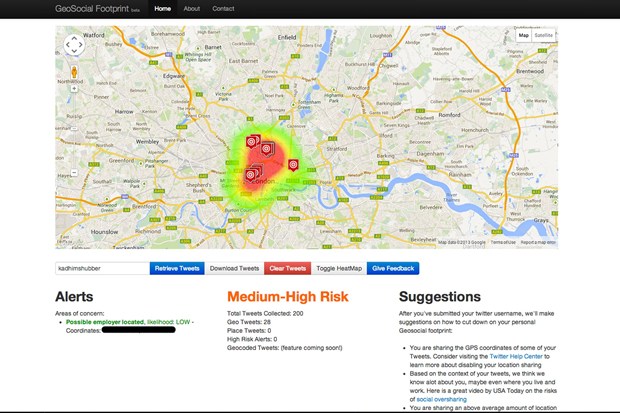
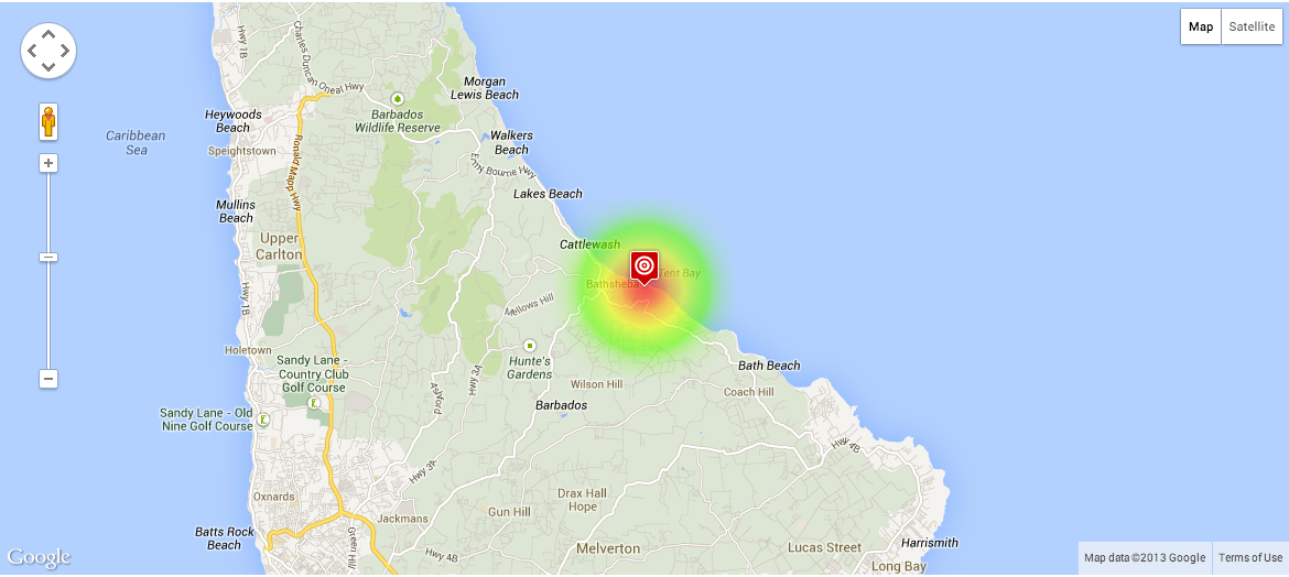
GeoSocial Footprint is a mapping app that accesses and correlates locational information from Twitter, effectively producing a user-specific geospatial footprint.
In a similar fashion to Ready or Not, an app developed by the University of California to teach people about online privacy protection, GeoSocial Footprint is user-specific service that visualises 'social hot spots'. While the app only works when a user has been geo-tagging their activity, according to creator Chris Weidemann, this accounts for some 30 million tweets, or 6 percent of Twitter activity. Taking this information, GeoSocial Footprint makes a users' whereabouts instantly available to anyone looking. Weidemann says he developed this service in an effort to educate social media users on the associated risks of divulging too much information online in order to help create an awareness among the general population about the information they choose to share.
While GeoSocial Footprint is still in its Beta version, the tool effectively highlights the concerns of over-sharing seemingly inconsequential information online, whereby you can track and view not just your own, but also your friends geospatial activity as it happens.
Discussion