Free Real-Time Transit App
Public transport is a pain at the best of times, which is why we’re always interested in hearing innovative ideas to get…

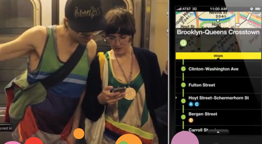
Public transport is a pain at the best of times, which is why we’re always interested in hearing innovative ideas to get one up on it. MateMate the routing guru app company who launched just short of a year ago is helping us do just that by providing its users with official transit maps, timetables and routing 100% free of charge. After a year of developing their services, they’ve now released their latest app and long-awaited solution to all your subway woes. NextTrain is the New York subway aid offering up to date and accurate information on train locations. The app turns everyday commuters into individual city mapping devices. How? The clever little programme tracks changes in Base Station Identification, the signals our phones connect to when above ground. It’s an amazing idea and another reason to add to the growing list of why we find it nearby impossible to part with our phones. Mobile tracking remains controversial and while the company claim to only ‘occasionally’ track users we’re not too sure how New Yorkers will feel about having their whereabouts transmitted across the city… The New York Post has recommended it though and while we’ll wait with bated breath for the app to hit London, any solution that promises to cut the time we city-dwellers have to sit on the underground has to be a good thing. Right? Click here to view the demo video and here to head over to the NextTrain website where you can decide for yourself. For those of you not too sure, the lovely guys at Google have recently announced that Google Maps now track transit buses in real time. Better buses than us.
Discussion